EUTM Somalia starts (2): on the Kampala Bihanga road
(BRUXELLES2 between Kampala and Bihanga) Kampala – Bihanga, 250 kms is about 7 hours drive. Suffice to say that once at the UPDF and EUTM camp in Bihanga, you won't be leaving anytime soon. But the trip is worth the detour and we get used to it… Well, not every day 🙂
Leaving Kampala, with both dense and anarchic traffic, the road begins, which sometimes gives way to the track, when it is not mud (when it rains). Better to leave early when it's hot. The road is sometimes impeccable (between Mbarara and Ibanda for example, redone). Sometimes it is in the state, with holes and bumps in the key and needs a hell of a facelift (like between Masaka and Mbarara). But, in many places, it is being repaired (with the support of the European Union).
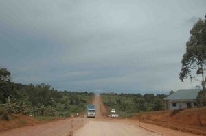
The most important danger is not only the surface but also the life around and on the road. Small merchants, shops are abundant. Pedestrians, bicycles loaded with bananas or wood, motorcyclists, overloaded trucks (with wood, bananas, various goods), 4x4s driving at full speed, cross paths there, with matatus (minibuses) and coasters (buses) to for better and for worse. Accidents are frequent. And it is strongly recommended not to ride at night. Most of the entrances to villages are also protected by zebus backs (a much larger speed bump) which forces you to slow down severely. And the police are watching. Posted every 20 or 30 kms, most often armed with radar, they do not hesitate to wield their arms to stop passing cars.

The landscapes are magnificent, very green. Banana plantations, a national crop in the region, are followed by rarer coffee plantations. As the kilometers go by, the valleys follow one another. And the trees are getting thicker, taller. It almost feels like a landscape in the Massif Central, with small streams, cows in the fields, etc.

In this part of the country the population is quite dense. And there are few uninhabited spaces, at least along the roads. The houses, or the schools in solid, often, are rather maintained with care. And Ugandans are naturally friendly. hello, welcome, how are you are required. And the first words of Swahili come quickly. With a little learning, we can then practice the Jambo (hello), Nzuri (how are you), ahsante (well thank you) punctuate the meetings, as well as the long warm handshake.

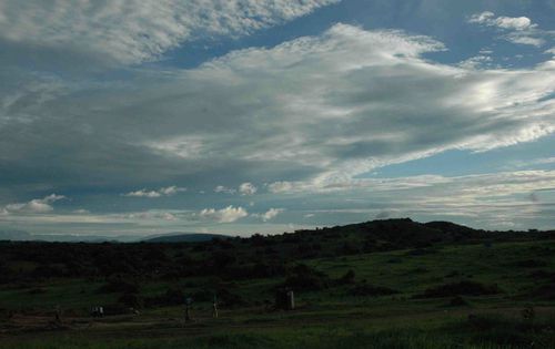
In Ibanda, we take a dirt and gravel track. And we finally arrive in Bihanga, in the depths of nowhere. On a hill, very quietly established, is the Ugandan army training camp, UPDF. Live here, with their families, in the traditional habitat, a few hundred Ugandan soldiers and officers. Only the head of the camp, Lieutenant Colonel Byaruhanga, is entitled to permanent accommodation. The Europeans settled at the other end of the UPDF camp, facing a hill and a sublime landscape in the morning.
(Nicolas Gros-Verheyde)